


Our starting point is the parking lot and crossroad sign for Komáří hůrka. From Krupka we may drive a car all the way to Komáří hůrka (little tower). If the weather is fine, the peak of Komáří hůrka offers excellent panoramic views of the Czech Central Mountains, the Krušné Mountains, Lužické Mountains and Jizerské Mountains. But regardless of what the weather is like, we can replenish our energy at the hotel restaurant. On our way down from the top to the crossroad, we may stop and examine the Chapel of St. Wolfgang built in 1700.
From the parking lot we will follow the red sign towards "Cínovec – city" (7.5 km). After a while we will arrive at a crossroad sign for Pod Komáří hůrkou and continue on a forest path through a lightly hilly terrain. The road zigzags between birches and silver pines and takes us to a meadow near the crossroad sign for Přední Cínovec.
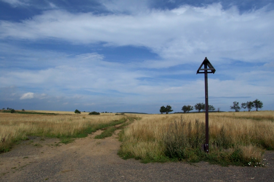
. From now on we will be riding in the territory of the Eastern Krušné Mountains Park. This park was established in 1995 with the intention to maintain and protect the typical countryside of the Krušné Mountains region. It occupies approximately 40 km2 of the upper land of the Krušné Mountains with an average altitude of 700 m. It is a largely deforested countryside, mostly used in the past for agricultural purposes. The biggest number of various species is concentrated in core areas, where scientists identified 23 types of protected plants and 32 species of birds listed in the Red Book of endangered and rare species.
Right behind the crossroad sign we face a rather difficult 0.5 km long uphill climb /2-3/. The climb becomes less steep as we come to a crossroad where our path meets the Krušnohorská ski trail, before taking a left turn to follow the Krušnohorská ski trail. This track follows a forest road all the way to the Pomezí Hotel near the E55 road. Here we will find a tourist crossroad sign from where we take a slight 1 km long climb and follow the blue signs all the way to Horní Cínovec. For easier navigation we will stick to the red signs going towards "Cínovec – city" and go through the entire city. Cínovec was founded during the early 14th century as a tin mining settlement. But later also silver and wolfram were mined here. Today the busy international E55 highway passes through here and the city lives primarily on tourism.
After visiting Cínovec we shall follow trail No. 23 all the way to the village of Fojtovice. On our right side we will see the Cínovecký Ridge and shortly after also Lysá Mountain. Less than 0.5 km before Fojtovice at a sharp right turn, we will find a gravestone where 59 victims of the Death march and one fallen Soviet soldier are buried. This reminds us that the countryside around us was not always an idyllic place for recreational tourism, but also a place where many human tragedies took place.
In the village of Fojtovice we will turn left again and join the asphalt road going towards Adolfov but at first, we start climbing up and around farm buildings and then around meadows and hillsides typical of this part of the Krušné Mountains. We continue on our path until we reach the village of Habartice. From Habartice we continue on the same road and follow the red signs towards "Adolfov" (2.5 km). Views of the beautiful mountain meadows in the core zone of the National Park will make most of our climb /2/ easier and happier. In the small, recreational village of Adolfov we may purchase refreshments. We then follow the red signs back to Hrabatice. From Hrabatice we continue to follow the red signs all the way to "Komáří Vížka" (2.5 km). The red sign follows a field road which crosses the large Fojtovická plain. From this plain only 1 km of a moderately steep climb separates us from Komáří hůrka*, where we have the opportunity to refresh ourselves and to enjoy the beautiful views of the already completed part of our journey. From the top we go down about 200 m to the parking lot where our trip comes to an end.
Total length 22.5 km.
* (you may avoid the climb if you turn right on the meadow and go back to Habartice where you can take a short climb up the road which will take you to the parking lot below Komáří hůrka)
Note: To shorten your trip, leave Fojtovice and follow the road for 1.5 km straight to the parking lot in Komáří hůrka (also know as Komáří Vížka – Tower).
The total length will then be 14.5 km.


