Our starting point is the city of Lovosice. Before we take off, we may visit the city centre where we find a Renaissance chateau from the early 17 century, the Baroque Church of St. Václav (Wenceslas) and many historic buildings all around the square. Not far from the square, near a junction with an underpass, we start our trip near the crossroad and follow the green sign towards "Lovoš" (3.5 km). Behind the railroad we will say good bye to the town of Lovosice and immediately after starting we begin with a sharp uphill climb. Tourist signs will take us around family houses and gardens all the way to the foothills of Lovoš Hill. Before we enter the forest in front of us, we will pass by fruit gardens and vineyards, which have a long tradition here and have been mentioned in chronicles since the 13th century. The higher we climb, the more the forest opens up and allows us to see Říp Mountain. From the crossroad Pod Lovošem (Under Lovoš)we shall undergo a 500 m long climb to the top (570 m), where we find a tourist cottage with a restaurant offering spectacular views in all directions. The top of Lovoš Hill is not only the dominant feature of the country side, but also an important national nature park/reservation. On its southern slopes we will find a wide variety of natural habitats such as rocky steppe, forest steppe and deciduous forest. We can learn more about the importance of this place if we take the educational trail (hereafter NS/ET).
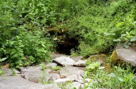
From the top down we follow the blue signs towards "Oparno". After a while we will encounter another ET stop – Lovoš – steppe blaze. If you want, you may walk a little bit farther until you reach the 6th stop of the ET, where you will find the Parenské kameny (Virgin stones) and may enjoy partial views of the Elbe River and the town of Lovosice. At a crossroad with a yellow sign we take a left turn towards "Boreč". We continue with our sharp descent through the woods until we join the road coming from Oparna. Here the road goes through open countryside, allowing us to enjoy more views of the Milešovka River and surrounding volcanic peaks. We shall cross the E 55 road and continue around the village of Bílinka until we reachRežný Újezd. In the village we will find the well-marked 3 km long Boreč educational trail. The aim of the educational trail is to explain and describe the attractions of the National nature monument called Borečský peak. This trachyte, mostly wooded hill is interwoven with a maze of cracks and fractured soil. During winter time, these cracks produce outbursts of warm air coming out of the upper cracks. Around these cracks you will see thermophilic plants and species. Near the ET stop "Pohledová výseč" you may enjoy nice views of the Czech Central Mountains. You may see many peaks from here such as Hrádek, Solanská Mountain, Líšeň, Ostrý, Hradišťany, Lipská Mountain, Ostrý, Franck's Mountain and Milešovka Mountain. On the top (446 m) we will find another ET stop – a diagram demonstrating the flow of air in the crack system. Between these rocks you may see small caves (ventaroly) through which the warm air flows out of the centre of the mountain during winter. The air accumulates here during warmer months when the mountain actually sucks the air in. The top of the mountain is covered with overgrown vegetation. Throughout our walk on the educational trail we mostly climb a path all the way to the top. And now, of course, we will go steeply down. Near the 7th stop of the ET we will find a viewing post overlooking Lovosice and Lovoš. Upon our return back to Režný Újezdwhere the ET begins and ends, we continue to follow the yellow signs. Behind Boreč the tourist signs will lead us off the road where we join a path, which will take us around a family house and then to the woods. We will walk through the forest and reach a crossroad sign Košťál – turn towards castle ruins. Here we can walk for 0.5 km to the top of a rocky basalt knot with the ruins of a Gothic castle. Although it is a very steep climb on a small path, the top offers such breathtaking panoramic views, that our efforts are well worth it. The Košťál peak, with its romantic castle ruins, was regularly painted by many painters (e.g. E. Filla). After visiting Košťál peak we will follow the green sign towards Vchynice. We walk downhill until we join a paved road. Keep watching our signs, which after some time will turn towards a small forest path covered with vegetation which takes us deeper into the forest. We come out of the forest below Ovčín peak, and while following its edge, we will reach the village ofRadostice. On our way to Vchynice we may again enjoy the beautiful views of Lovoš, Milešovka and the surrounding countryside. To return back to Lovosice,where our trip ends, we follow the blue signs. Total length 22.5 km


