


Our trip begins in the town of Mikulášovice. The first record mentioning this coal-mining settlement, which belonged to the tolštejn – šluknovské estates dates back to 1446. During World War II the local industry was transformed into a military production. Many prisoners of war and multinational labourers worked here. The town square houses a Memorial dedicated to the liberators – the forces of the 2nd Polish army. The town is dominated by the Church of St. Mikuláš (Nicholas), built between 1551 and 1555, later reconstructed in the Baroque style and given a new appearance – the same appearance as we know today. Inside the church you will find a richly carved Rococo altar and organ with more than 3000 pipes. You may also sporadically see well-preserved classical town houses and wooden two-story houses with foundation bases.
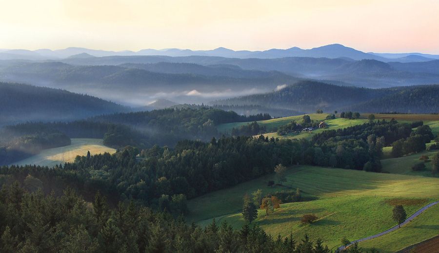
From the square we start following the blue sign towards the "Tanečnice (Dancer) – viewing tower" (4 km). We pass by the ČSD Mikulášovice (Railway station) and while climbing slightly uphill a nice view of the town of Mikulášovice can be enjoyed behind us. At the Tomášov crossroads a decision about whether you have enough time and physical strength to extend your trip a little bit and climb up to the Dancer tower (additional 3 km) must be made. Upon deciding on a visit to the viewing tower, we shall turn and go deeper into the woods and begin a sharp climb until we reach the top of the hill (597 AMSL). On the top of Dancer Hill we find an octagonal, 26-metre high viewing tower, built in 1905 and equipped with an excellent circular viewing platform. After the viewing tower was damaged by fire, a new cottage with a restaurant was built here. You can refresh yourself in the restaurant and also buy a ticket for the viewing tower. We will take the same road to get back to our trail which will take us to Tomášov and continue following it until we reach a small settlement in the middle of the dense Tomášovský Forest. We will pass by the resort centre but after that the forest devours us again. We continue past an abandoned tourist border crossing and after a while are walking among fields and meadows towards the Waldhaus (guesthouse) restaurant. Here we will join the blue sign trail (Dr. Alfred Weg Meiche) towards Wachberg and travel alongside a busy traffic road. Another part of our trip goes along the forest edge and offers nice views of Šluknovská vrchovina (Šluknovská Heights) and the German section of the Elbe sandstones area. To get to the top, we have to overcome a short but steep climb through the woods. On the top we will get our reward. A beautiful view of the Elbe sandstone area and the Lužické Mountains. In front of the restaurant with a nice glass terrace we find several information boards telling us the names of the mountains we may see from up here. In the east you can clearly see Weifberg Mountain (477.8 m) with a new viewing tower – our last destination. When we get back to the woods under Wachberg, we begin following the red tourist signs for a change and walk through a hilly terrain along the state borderline until we reach the Pod Weifbergem crossroad. Now only 500 m separates us from the top where the new viewing tower was built in 2000. The freely accessible viewing tower is 36.9 m high and has 173 steps, 10 floors and offers excellent views in any direction. To go back to Mikulášovice we take the yellow signs, which follow a rather damaged road, over the saddle between Hraniční Hill and Hanlový Hill. Total length 14.5 km (detour to Tanečnice (Dancer) additional 3 km).


