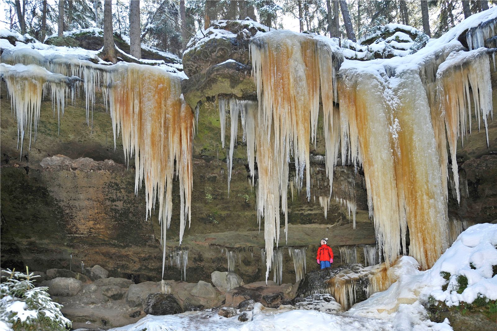


As the starting point for this trip we have selected the village of Brtníky. Here, you will find a crossroads sign. From here we will take the green sign direction towards "Údolí Křinice (Křinice Valley) - Turistický most (Tourist Bridge)" / 4.5 km /. The sign will take you around pretty wooden cottages and then out of the village, where we leave the paved road and take a slight uphill path /2/ across meadows to pine woods located at the top of the hill above the village. Then we continue on a nearly flat plain until we reach a sunny meadow with a pond, where we will find the Šternberk convalescence home. This home is located at the place of the former park with a small hunting chateau. After 500 metres we will arrive at the beginning of a rock town, which will present itself with the pleasant Soví vyhlídka (Owl Viewing Tower) facing the valley of Vlčí potok (Wolf's Creek) enclosed with rocks. A short distance behind Soví vyhlídka (Owl Viewing Tower), you may take a left and go down into a ravine surrounded by rocks, where after about 100 m you will see a "black hole" - the entrance to the Soví díra (Owl's Hole Cave) You may walk through the cave. When you come out you will see massive sandstone blocks. Then we may continue to follow the tourist marks until we reach a crossroad in the woods, where admirers of ice waterfalls should definitely take a left and go into another ravine, where after about 250 metres they can enjoy the beauty of the ice waterfall curtain Another tourist attraction on this route is hidden on your left side. To get there take the hidden left turn again at the crossroad called Velký pruský tábor (the Large Prussian Camp). You may reach the massive rock overhang, under which the Prussian soldiers broke out their camp, through a narrow rock crevasse. After another 200 m you will see another turn, which will take you to yet another sight and that is Brtnický hrádek (Brtník Castle). With the help of steel ladders and handrails you will reach a rising rocky headland, where a watch castle from the 14th century used to be. The sandstones here still show visible remains of the cellar and the castle's wooden structure. This place offers a beautiful view of the countryside. From the Brtnický Castle (Brtník Castle) crossroad sign we will go down to the valley of Vlčí potok (Wolf's Brook), where you can admire the beauty of many water icefalls. To get there, you should continue to the left, against the stream. Above the creek you will see the icefalls Betlém (Bethlehem) and Varhany (Organ). There is a very attractive icefall called Velký sloup (the Big Column Icefall), , which can be reached if you go across a wooden bridge over Vlčí potok (Wolf's Brook) located on your right side. This forest path (in winter the path is usually visible thanks to footprints) will take you to the 8-metre-high overhang where a huge icefall may be seen during the winter. Others may choose not to take the detour and go against the stream of Vlčí potok (Wolf's Brook) and go down and follow the tourist sign through a rocky ravine to the bridge over the Křinice River, where you will find a resting place and a crossroads - Turistický most (Tourist Bridge). Then we follow the red tourist sign through the picturesque valley and meanders of the Křinický Brook until we reach the crossroads Bývalá Zadní Doubice (Former Zadní Doubice) /2 km/, located near the confluence of the Křinice River and Brtnický Brook. The blue tourist sign will take us against the brook stream for about /3.5 km/. The Brtnický Brook flows through wild and rocky valleys, where you will see many interesting icefalls during the winter. In summer, however, you will appreciate the forest shadows and cold rocks that are so different from the sunny pine groves you saw in the first part of your trip. Near the Chapel of St. Antonín (St. Anthony) we leave the world of rocks and come to the picturesque village of Kopec (Hill), where you can admire beautiful half-timbered houses with foundation bases. From the crossroad sign in the village we will walk for 2 km on a deserted path, which brings us to the beginning of the village of Brtníky where we end our trip. Total length 14 km (if you take the icefalls detour - 18 km)


